Satellite imagery classification - III
Classification with the help of the Python eobox package.
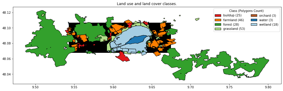
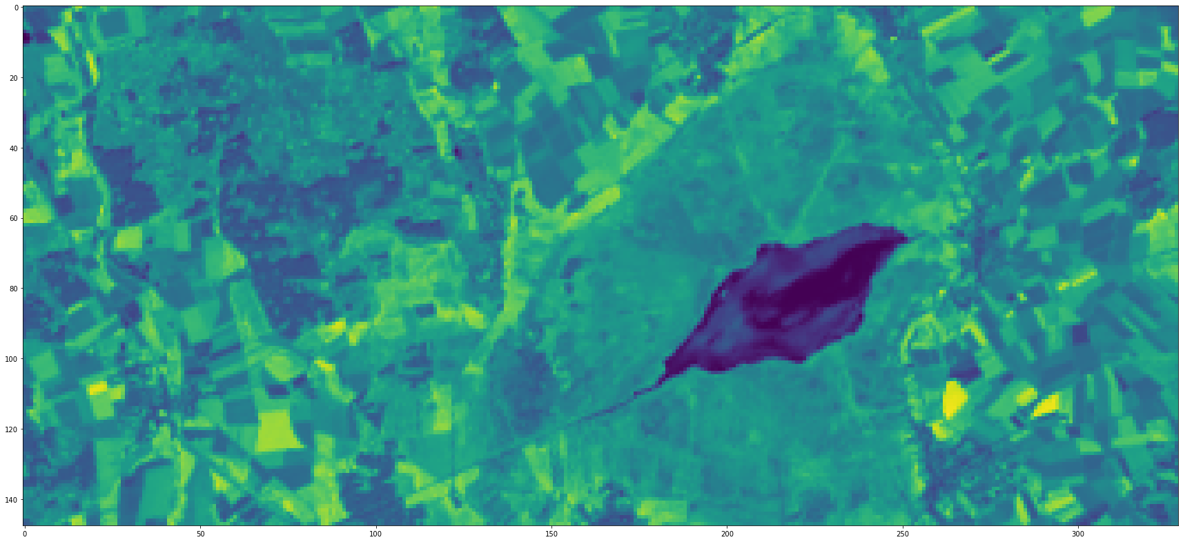
This is the third and last part of a blog post series about using remote sensing data to classify the earth’s surface. In this post we will finally walk through the typical steps it takes to classify remote sensing images with a supervised classifier to derive a land use/land cover map.