intro-pic

Ben's Blog

... | data | geospatial | python | remote sensing | ...

Comparing USGS ShakeMap versions

The M 7.1 - 72 km ENE of Namie, Japan earthquake.

7-Minute Read

output_26_0.png

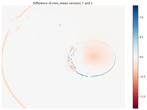
Recently, I came across the question if and how it is possible to download superseded versions of ShakeMaps distributed by the USGS Earthquake Hazards program. This post comprises what I encountered on my first walk through the rich resources offered by the USGS.

Satellite imagery classification - III

Classification with the help of the Python eobox package.

20-Minute Read

output_30_0.png

This is the third and last part of a blog post series about using remote sensing data to classify the earth’s surface. In this post we will finally walk through the typical steps it takes to classify remote sensing images with a supervised classifier to derive a land use/land cover map.

Satellite imagery classification - II

Downloading and preparing OpenStreetMap data

17-Minute Read

output_39_0.png

This is the second part of a three parts series about using remote sensing data to classify the earth’s surface. Please read the first part of the series if you are interested in an introduction to the post series and / or in the first part where we downloaded parts of Landsat scenes by leveraging the Cloud Optimized GeoTIFF format.

Recent Posts

About

Mini Autobiography